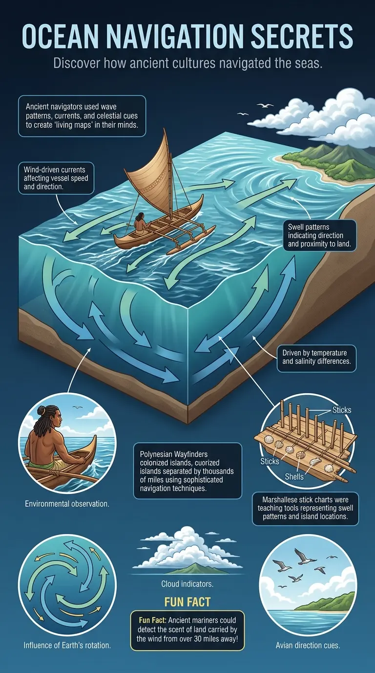
Explore the incredible techniques ancient mariners used to navigate vast oceans by decoding currents, wave patterns, and other natural cues. Learn about Polynesian wayfinding and Marshallese stick charts. Read the full article to discover more! #ancientnavigation #oceanography #wayfinding #history #maritime #infographic
Read The Full Blog Join Us


Comments
Alex Rivers 2 days ago
This visualization completely changes how I understand this topic. Amazing work!