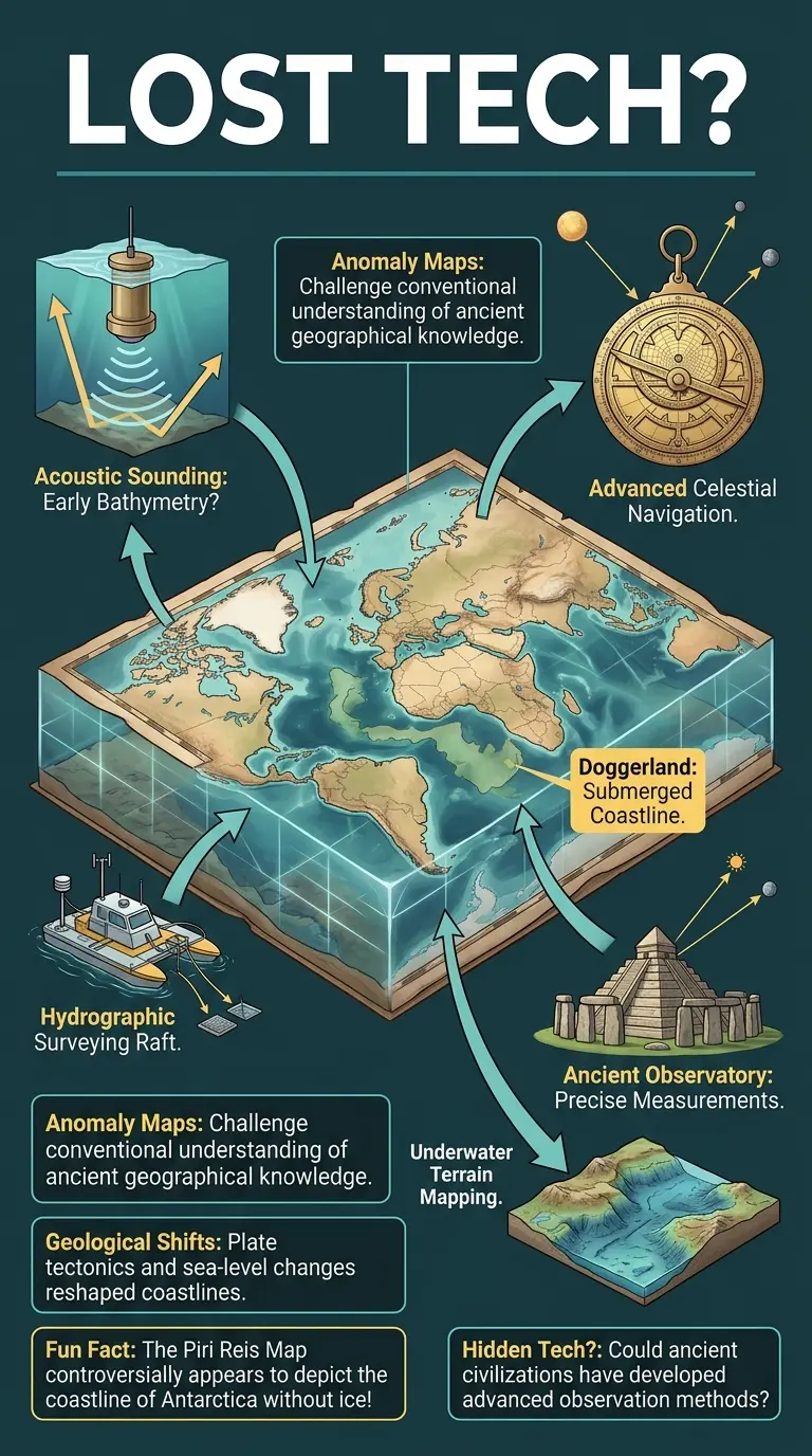
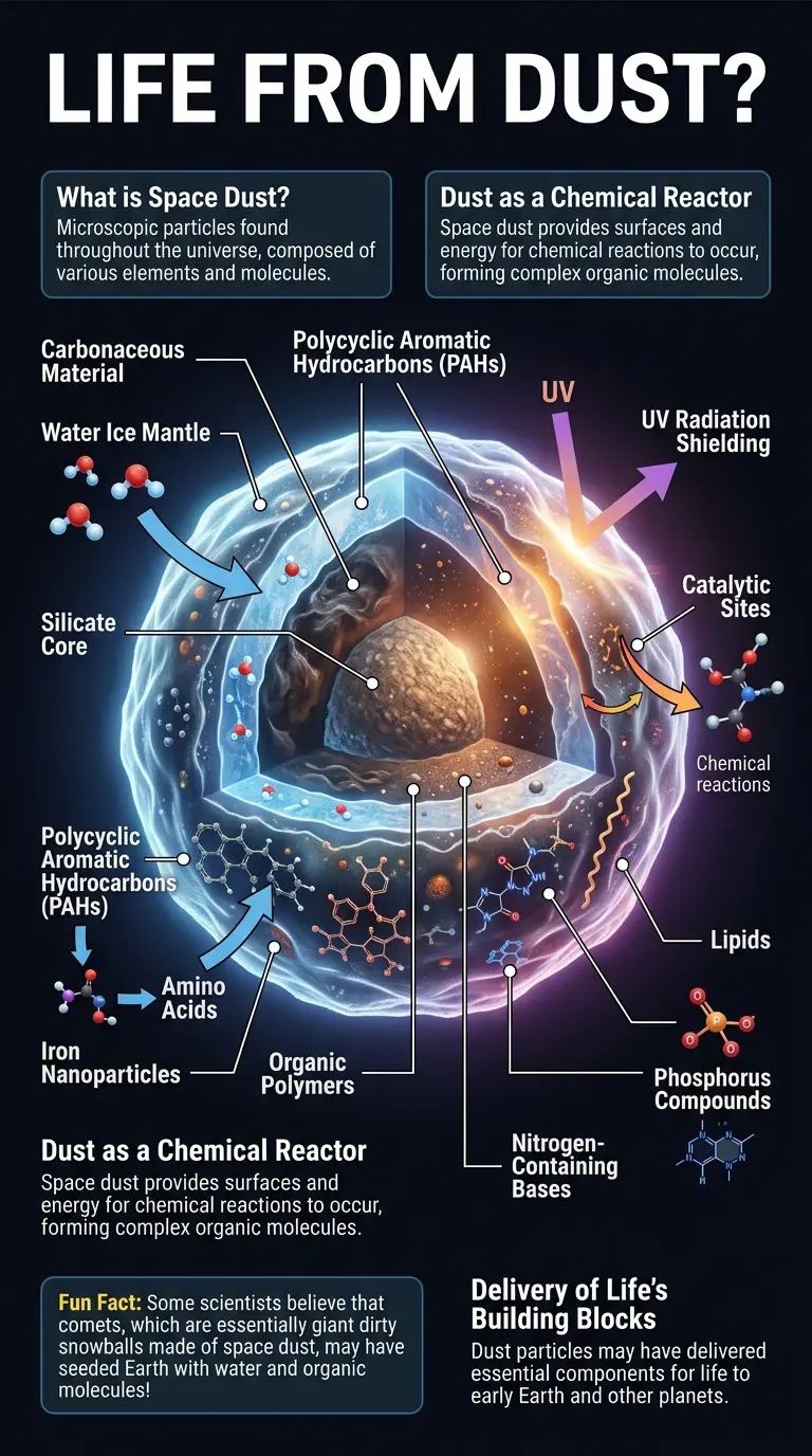
Explore the mystery of ancient maps that seem to depict lost continents and ice-free polar regions! 🌍 Were they using a "hidden tech" or did they have advanced knowledge we're only now rediscovering? Read the full article to uncover the secrets! #ancientmaps #lostcontinents #hiddenhistory #cartography #ancienttechnology #curiositydiaries
Read The Full Blog Join Us


Comments
Alex Rivers 2 days ago
This visualization completely changes how I understand this topic. Amazing work!